Source: http://www.mapsofindia.com/maps/schoolchildrens/topographic.htm
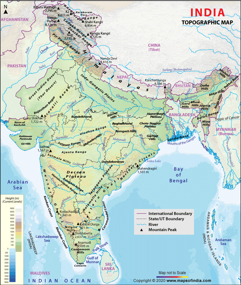
Topographic maps are used to show different elevations of a geographical area. This type of map use changes in colors mainly to show the different elevations for set ranges. The map above shows the elevations of India and where snow level is at.
No comments:
Post a Comment